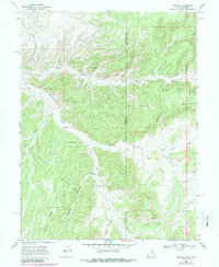
1968 Map of Dragon
USGS Topo · Published 1987About this map
Dragon stands as a focal point in this high-desert landscape on the border of Utah and Colorado, where industrial extraction and isolated geography meet. This 1968 survey, revised in the late 1980s, highlights the Evacuation Creek Gas Field and several resource extraction sites including a Mine and various Prospects scattered across the drainages. The area is defined by a network of deep incisions like Park Canyon and Dragon Canyon, which funnel toward Evacuation Creek. Evidence of settlement and activity is sparse but significant, with a Grave and an Industrial Waste Pond noted near the central drainage. The presence of a Trench, multiple Jeep Trails, and a Pipeline reflects the 20th-century development of the region's energy infrastructure amidst the complex topography of Rector Ridge and Park Mountain.
Find a feature on this map
23 named features on this map. Tap any name to fly to it.
Don’t see what you’re looking for? This feature index may not catch every label — zoom into the map to look around manually.
Map Details
Editions of this 1968 Dragon Map
2 editions found
Other maps of this area

1885 · East Tavaputs
USGS Topo · 1:250,000

1956 · Grand Junction
USGS Topo · 1:250,000

1959 · Grand Junction
USGS Topo · 1:250,000

1960 · Grand Junction
USGS Topo · 1:250,000

1962 · Grand Junction
USGS Topo · 1:250,000

1964 · Grand Junction
USGS Topo · 1:250,000

1964 · Texas Creek
USGS Topo · 1:24,000

1964 · East Evacuation Creek
USGS Topo · 1:24,000
1964 · Banta Ridge
USGS Topo · 1:24,000

1965 · Grand Junction
USGS Topo · 1:250,000