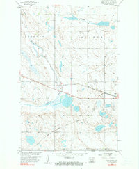
1958 Map of Drake NW
USGS Topo · Published 1990About this map
The Minneapolis St Paul and Sault Ste Marie rail corridor dominates this central North Dakota landscape, running through the growing community of Drake and past the aviation grounds at the Landing Field. This era of the late 1950s shows the heavy reliance on these rail lines for transporting grain and regional resources through the prairie. To the west of town, the waters of the Wintering River feed into Bentley Lake, near which Camp Bentley provided a local landmark for outdoor gatherings. The terrain is defined by the broad Antelope Valley and the elevation of Montgomery Hill, while the local infrastructure includes a rural Town Hall and a Gravel Pit, reflecting the agrarian and industrial foundations of McHenry County. The map provides a look at the township boundaries of Balfour, Strege, Land, and Spring Grove before later modern developments altered the local drainage patterns.
Find a feature on this map
16 named features on this map. Tap any name to fly to it.
Don’t see what you’re looking for? This feature index may not catch every label — zoom into the map to look around manually.
Map Details
Editions of this 1958 Drake NW Map
2 editions found
Other maps of this area

1929 · Balfour
USGS Topo · 1:62,500

1930 · Drake
USGS Topo · 1:62,500

1954 · Minot
USGS Topo · 1:250,000

1954 · McClusky
USGS Topo · 1:250,000

1957 · Karlsruhe
USGS Topo · 1:24,000

1957 · Rangeley SE
USGS Topo · 1:24,000

1957 · Rangeley
USGS Topo · 1:24,000

1958 · McClusky
USGS Topo · 1:250,000

1958 · Minot
USGS Topo · 1:250,000

1958 · Drake
USGS Topo · 1:62,500