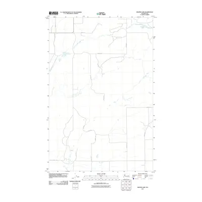
2011 Map of Draper Lake
USGS Topo · Published 2011About this map
Canniwai Creek meanders through this portion of Lincoln County, defining a landscape marked by seasonal water sources and a rigid grid of rural transport. The area is characterized by scattered wetlands and small bodies of water like Draper Lake and Bergeau Lake, which serve as vital landmarks in an otherwise open terrain. This 2011 survey captures a network of long-established section-line roads, many bearing the names of local families such as Wagner Rd N, Bergeau Rd N, Zagelow Rd N, and McNew Rd N. These names provide a direct link to the agricultural heritage and land ownership patterns of the region. Near the southern edge, Eagle Spring and the associated Eagle Springs Rd E indicate the importance of natural springs for early settlement and livestock in this part of Washington.
Find a feature on this map
17 named features on this map. Tap any name to fly to it.
Don’t see what you’re looking for? This feature index may not catch every label — zoom into the map to look around manually.
Map Details
Editions of this 2011 Draper Lake Map
This is the sole edition of this map. No revisions or reprints were ever made.
Other maps of this area

1953 · Ritzville
USGS Topo · 1:250,000

1959 · Ritzville
USGS Topo · 1:250,000

1965 · Ritzville
USGS Topo · 1:250,000

1968 · Coffeepot Lake
USGS Topo · 1:24,000

1968 · Pacific Lake
USGS Topo · 1:24,000

1968 · Sullivan Lake
USGS Topo · 1:24,000

1969 · Almira SE
USGS Topo · 1:24,000

1969 · Govan
USGS Topo · 1:24,000

1969 · Creston Butte
USGS Topo · 1:24,000

1969 · Wagner Lake
USGS Topo · 1:24,000