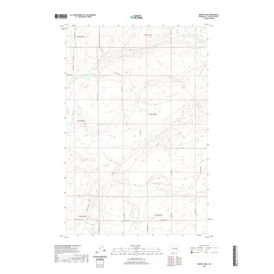
2020 Map of Draper Lake
USGS Topo · Published 2020About this map
Draper Lake and its surrounding basalt-carved landscape are the primary features of this northern Lincoln County map, which documents a sparsely settled agricultural and ranching region. The terrain is marked by the complex drainage systems of Canniwai Cr and seasonal water bodies like Bergeau Lake, reflecting the hydrological character of the Channeled Scablands. A network of rural section-line roads, including Apache Pass Rd N and Wagner Rd N, provides access to remote acreage and spring sites. In the southern reaches, Eagle Spring and Eagle Spring Lake indicate critical water sources that have long anchored local land use. The map's grid, defined by township boundaries like t24n r32e, highlights the orderly division of the territory among historical landowners such as those named on Schmierer Rd and Zagelow Rd N.
Find a feature on this map
24 named features on this map. Tap any name to fly to it.
Don’t see what you’re looking for? This feature index may not catch every label — zoom into the map to look around manually.
Map Details
Editions of this 2020 Draper Lake Map
This is the sole edition of this map. No revisions or reprints were ever made.
Other maps of this area

1953 · Ritzville
USGS Topo · 1:250,000

1959 · Ritzville
USGS Topo · 1:250,000

1965 · Ritzville
USGS Topo · 1:250,000

1968 · Coffeepot Lake
USGS Topo · 1:24,000

1968 · Pacific Lake
USGS Topo · 1:24,000

1968 · Sullivan Lake
USGS Topo · 1:24,000

1969 · Almira SE
USGS Topo · 1:24,000

1969 · Govan
USGS Topo · 1:24,000

1969 · Creston Butte
USGS Topo · 1:24,000

1969 · Wagner Lake
USGS Topo · 1:24,000