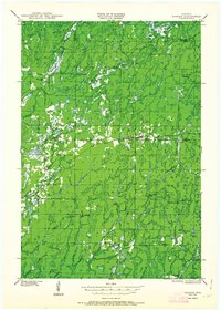
1947 Map of Draper
USGS Topo · Published 1963About this map
Timber and rail networks define this Sawyer County landscape, where the Minneapolis St Paul and Sault Ste Marie Railroad and the Chicago St Paul Minneapolis and Omaha Railway converge near the settlements of Loretta and Draper. The map records a transition from active logging to conservation, with numerous former work sites such as Old Le May Camp and Old Christmas Camp scattered through the woods. Surveillance of the surrounding Flambeau River State Forest is maintained through a network of lookouts, including the Black Lake Fire Tower and the Brunet Fire Tower, while local community life is anchored by the Loretta Cem and Barber Lake Sch. Significant water features like Blaisdell Lake and the Chippewa River dominate the northern terrain, illustrating the region's historical reliance on its waterways and rail lines.
Find a feature on this map
49 named features on this map. Tap any name to fly to it.
Don’t see what you’re looking for? This feature index may not catch every label — zoom into the map to look around manually.
Map Details
Editions of this 1947 Draper Map
2 editions found

Other maps of this area

1941 · Kennan
USGS Topo · 1:48,000

1941 · Kennedy
USGS Topo · 1:48,000

1942 · Glidden
USGS Topo · 1:48,000

1942 · Clam Lake
USGS Topo · 1:48,000

1943 · Namekagon Lake
USGS Topo · 1:48,000

1944 · Exeland
USGS Topo · 1:48,000

1944 · Draper
USGS Topo · 1:48,000

1944 · Radisson
USGS Topo · 1:48,000

1945 · Kennedy
USGS Topo · 1:48,000

1945 · Namekagon Lake
USGS Topo · 1:48,000