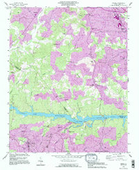
1993 Map of Drexel
USGS Topo · Published 1995About this map
Rhodhiss Lake and the Catawba River serve as the central geographic divide in this mid-1990s survey, separating the burgeoning communities of Drexel and Valdese to the south from the upland areas of Caldwell Co to the north. This document reflects a landscape in transition, where established towns and educational hubs like Rutherford College sit alongside industrial infrastructure, including a Sewage Disposal plant and a Filtration Plant.
Find a feature on this map
65 named features on this map. Tap any name to fly to it.
Don’t see what you’re looking for? This feature index may not catch every label — zoom into the map to look around manually.
Map Details
Editions of this 1993 Drexel Map
2 editions found
Other maps of this area

1895 · Hickory
USGS Topo · 1:125,000

1905 · Morganton
USGS Topo · 1:125,000

1953 · Charlotte
USGS Topo · 1:250,000

1954 · Charlotte
USGS Topo · 1:250,000

1956 · Valdese
USGS Topo · 1:24,000

1956 · Collettsville
USGS Topo · 1:24,000

1956 · Morganton North
USGS Topo · 1:24,000

1956 · Morganton South
USGS Topo · 1:24,000

1956 · Lenoir
USGS Topo · 1:24,000

1956 · Drexel
USGS Topo · 1:24,000