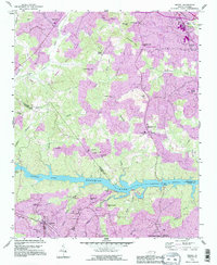
1993 Map of Drexel
USGS Topo · Published 1996About this map
Rhodhiss Lake anchors this landscape at the boundary of Caldwell and Burke Counties, where the Catawba River winds through a series of significant mid-century industrial and residential expansions. The map illustrates the growth of manufacturing and utility infrastructure in Drexel and Valdese, evidenced by the large Sewage Disposal and Filtration Plant facilities along the riverbank. This era saw the consolidation of community life around established institutions like Philadelphia Church and Colliers Church, while the Lenoir-Morganton Airport near Gamewell highlights the region's increasing regional connectivity. The transition from older rural crossings like Corpening Bridge to modern spans like Castle Bridge reflects the modernization of the foothills during the late twentieth century, even as family landmarks like Puett Cemetery maintain the area's genealogical ties.
Find a feature on this map
56 named features on this map. Tap any name to fly to it.
Don’t see what you’re looking for? This feature index may not catch every label — zoom into the map to look around manually.
Map Details
Editions of this 1993 Drexel Map
2 editions found
Other maps of this area

1895 · Hickory
USGS Topo · 1:125,000

1905 · Morganton
USGS Topo · 1:125,000

1953 · Charlotte
USGS Topo · 1:250,000

1954 · Charlotte
USGS Topo · 1:250,000

1956 · Valdese
USGS Topo · 1:24,000

1956 · Collettsville
USGS Topo · 1:24,000

1956 · Morganton North
USGS Topo · 1:24,000

1956 · Morganton South
USGS Topo · 1:24,000

1956 · Lenoir
USGS Topo · 1:24,000

1956 · Drexel
USGS Topo · 1:24,000