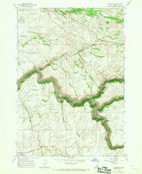
1965 Map of Drummond
USGS Topo · Published 1967About this map
Agricultural operations and the canyon systems of the upper Snake River plain define this mid-1960s landscape. The Union Pacific railroad line cuts across the northern terrain, serving the village of Drummond and several rural infrastructure points including a Grain Elevator and Storage Bins at France. The dramatic convergence of Bitch Creek and the Teton River creates deep incisions in the plateau, where industrial development is marked by a Powerhouse, Penstocks, and a Substation. To the north, Henry Meadow and the Camp Henry Historic Site indicate early settlement patterns near Conant Creek. In the southwest corner, the small community of Clementsville sits near a local Landing Strip, while the Farnum Cem remains as a genealogical marker for the surrounding homesteading families in this remote corner of Eastern Idaho.
Find a feature on this map
19 named features on this map. Tap any name to fly to it.
Don’t see what you’re looking for? This feature index may not catch every label — zoom into the map to look around manually.
Map Details
Editions of this 1965 Drummond Map
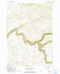
2 editions found
Other maps of this area

1955 · Ashton
USGS Topo · 1:250,000

1955 · Driggs
USGS Topo · 1:250,000

1957 · Warm River Butte
USGS Topo · 1:62,500

1958 · Driggs
USGS Topo · 1:250,000

1958 · Ashton
USGS Topo · 1:250,000

1960 · Ashton
USGS Topo · 1:250,000

1962 · Driggs
USGS Topo · 1:250,000

1965 · Lamont
USGS Topo · 1:24,000

1965 · Ashton
USGS Topo · 1:24,000

1965 · Packsaddle Lake
USGS Topo · 1:24,000