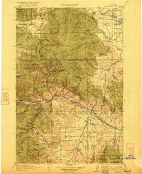
1921 Map of Drummond
USGS Topo · Published 1921About this map
Clark Fork and the Blackfoot River dominate this western Montana landscape, recorded just as the region's ranching and mining patterns were firmly established. The map highlights the rugged Garnet Range separating the two river valleys, where mountain settlements like Garnet and Coloma contrast with the agricultural valley floor. Transportation is defined by the Chicago Northern Pacific and Milwaukee and St Paul railroads, which parallel the river courses and connect early communities such as Drummond, New Chicago, and Bearmouth.
Find a feature on this map
81 named features on this map. Tap any name to fly to it.
Don’t see what you’re looking for? This feature index may not catch every label — zoom into the map to look around manually.
Map Details
Editions of this 1921 Drummond Map
3 editions found

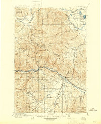
Other maps of this area

1889 · Helena
USGS Topo · 1:250,000

1893 · Helena
USGS Topo · 1:250,000

1899 · Helena
USGS Topo · 1:250,000

1902 · Ovando
USGS Topo · 1:125,000

1903 · Coopers Lake
USGS Topo · 1:125,000

1903 · Bonner
USGS Topo · 1:125,000

1903 · Helena
USGS Topo · 1:250,000

1905 · Ovando
USGS Topo · 1:125,000

1908 · Philipsburg
USGS Topo · 1:125,000

1909 · Sapphire
USGS Topo · 1:125,000