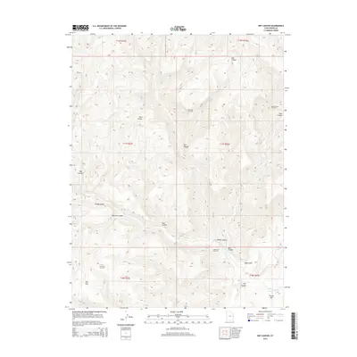
2014 Map of Dry Canyon
USGS Topo · Published 2014About this map
The Robidoux Inscription serves as a singular historical waypoint in this high-desert landscape of Grand County, reflecting the deep history of travel through the region's complex drainages. The terrain is characterized by a series of significant erosional features, including Bull Canyon, Dark Canyon, and Maverick Canyon, which feed into the Westwater Cr system. To the south, the dramatic rise of the Book Cliffs dominates the topography, providing a stark vertical contrast to the canyon floors below.
Find a feature on this map
23 named features on this map. Tap any name to fly to it.
Don’t see what you’re looking for? This feature index may not catch every label — zoom into the map to look around manually.
Map Details
Editions of this 2014 Dry Canyon Map
This is the sole edition of this map. No revisions or reprints were ever made.
Other maps of this area

1885 · East Tavaputs
USGS Topo · 1:250,000

1956 · Grand Junction
USGS Topo · 1:250,000

1959 · Grand Junction
USGS Topo · 1:250,000

1960 · Grand Junction
USGS Topo · 1:250,000

1962 · Grand Junction
USGS Topo · 1:250,000

1964 · Grand Junction
USGS Topo · 1:250,000

1965 · Grand Junction
USGS Topo · 1:250,000
1970 · Harley Dome
USGS Topo · 1:24,000

1970 · Flume Canyon
USGS Topo · 1:24,000
1970 · Cedar Camp Canyon
USGS Topo · 1:24,000