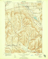
1951 Map of Dryden
USGS Topo · Published 1951About this map
The village of Dryden serves as a northern anchor in this mid-century portrait of Tompkins County, where the Lehigh Valley Railroad cuts a diagonal path toward Dryden Lake. This transport corridor contrasts with the high elevations of the southern terrain, dominated by the peaks of Yellow Barn Hill, Beam Hill, and Star Stanton Hill. The landscape is defined by its drainage patterns, with Fall Creek in the northwest and the West Branch Owego Creek flowing south toward Tioga County.
Find a feature on this map
31 named features on this map. Tap any name to fly to it.
Don’t see what you’re looking for? This feature index may not catch every label — zoom into the map to look around manually.
Map Details
Editions of this 1951 Dryden Map
2 editions found
Other maps of this area

1898 · Moravia
USGS Topo · 1:62,500

1900 · Dryden
USGS Topo · 1:62,500

1902 · Moravia
USGS Topo · 1:62,500

1903 · Cortland
USGS Topo · 1:62,500

1903 · Harford
USGS Topo · 1:62,500

1906 · Catatonk
USGS Topo · 1:125,000

1942 · Groton
USGS Topo · 1:24,000

1943 · West Groton
USGS Topo · 1:31,680

1943 · Groton
USGS Topo · 1:31,680

1944 · Cortland
USGS Topo · 1:31,680