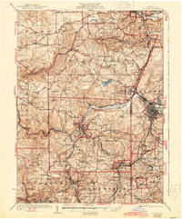
1924 Map of Du Bois
USGS Topo · Published 1944About this map
Reynoldsville and Du Bois serve as the primary hubs in this western Pennsylvania landscape, where the coal and rail industries dictated the layout of 1920s settlements. The map reveals a complex industrial geography, with the Shawmut and Northern RR and the Buffalo Rochester and Pittsburgh RR threading through the valleys to serve coal-rich pockets like Coal Glen and Beechtree. Dozens of neighborhood schools, such as Mason School, Rought School, and Mile Hill School, are scattered across the townships of Warsaw, Washington, and Winslow, marking the centers of rural community life before the consolidation of rural districts.
Find a feature on this map
129 named features on this map. Tap any name to fly to it.
Don’t see what you’re looking for? This feature index may not catch every label — zoom into the map to look around manually.
Map Details
Editions of this 1924 Du Bois Map
5 editions found
Other maps of this area

1903 · Curwensville
USGS Topo · 1:62,500

1906 · Punxsutawney
USGS Topo · 1:62,500

1909 · Smicksburg
USGS Topo · 1:62,500

1918 · Loleta
USGS Topo · 1:62,500

1922 · Du Bois
USGS Topo · 1:62,500

1924 · Du Bois
USGS Topo · 1:62,500

1924 · Brookville
USGS Topo · 1:62,500

1926 · Brookville
USGS Topo · 1:62,500

1929 · Penfield
USGS Topo · 1:62,500

1932 · Penfield
USGS Topo · 1:62,500