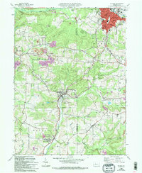
1966 Map of Du Bois
USGS Topo · Published 1994About this map
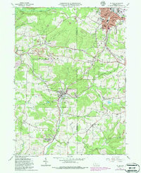
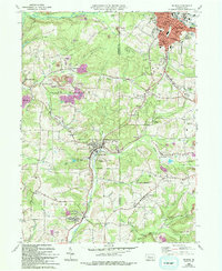
Extensive industrial activity defines the landscape between Du Bois and Sykesville, where numerous strip mines and reclaimed strip mines surround the smaller coal-and-rail settlements. The transition from industrial extraction to rural farmland is evident as one moves south toward Troutville and Stump Creek. The influence of the area's rail history is captured in the Old O & R RR Grade, which cuts through the terrain near Soldier. This survey offers a detailed view of local genealogy through numerous burial sites and churches, including Shaffer Memorial Cem, Soldier Hill Cem, and the Paradise Ch in Henderson township. The map also delineates the corporate boundaries of Du Bois, where civic infrastructure like City Hall, the Hospital, and Jr High Sch are established near Sandy Lick Creek.
Find a feature on this map
67 named features on this map. Tap any name to fly to it.
Don’t see what you’re looking for? This feature index may not catch every label — zoom into the map to look around manually.
Map Details
Editions of this 1966 Du Bois Map
6 editions found
Other maps of this area

1903 · Curwensville
USGS Topo · 1:62,500

1906 · Punxsutawney
USGS Topo · 1:62,500

1922 · Du Bois
USGS Topo · 1:62,500

1924 · Du Bois
USGS Topo · 1:62,500

1929 · Penfield
USGS Topo · 1:62,500

1932 · Penfield
USGS Topo · 1:62,500

1939 · Curwensville
USGS Topo · 1:62,500

1939 · Punxsutawney
USGS Topo · 1:62,500

1942 · Curwensville
USGS Topo · 1:62,500

1942 · Punxsutawney
USGS Topo · 1:62,500