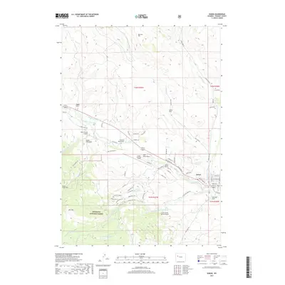
2017 Map of Dubois
USGS Topo · Published 2017About this map
Dubois sits at the heart of this mountain landscape, positioned where the Wind River flows through the high country of Fremont County. The map documents the town's modern layout, including the Dubois Municipal Airport and the Dubois Cem, alongside the irrigation infrastructure essential to the region like the Green Ditch and Holmes Number 1 Ditch. To the west and south, the terrain rises into the Shoshone National Forest, characterized by landmarks such as Battrum Mtn and Bald Mtn. A network of named trails and roads, including the Geyser Creek Trl and Warm Springs Rd, provides access to narrow drainages like Warm Spring Canyon and Chimney Rock Gulch. The hydrography of the area is further defined by Hart Reservoir, Grandy Reservoir, and numerous creeks that feed into the main river valley.
Find a feature on this map
64 named features on this map. Tap any name to fly to it.
Don’t see what you’re looking for? This feature index may not catch every label — zoom into the map to look around manually.
Map Details
Editions of this 2017 Dubois Map
This is the sole edition of this map. No revisions or reprints were ever made.
Other maps of this area

1905 · Younts Peak
USGS Topo · 1:125,000

1907 · Younts Peak
USGS Topo · 1:125,000

1909 · Fremont Peak
USGS Topo · 1:125,000

1955 · Thermopolis
USGS Topo · 1:250,000

1956 · Indian Point
USGS Topo · 1:24,000

1956 · Dubois
USGS Topo · 1:24,000

1956 · Esmond Park
USGS Topo · 1:24,000

1956 · Ramshorn Peak
USGS Topo · 1:24,000

1956 · Warm Spring Mountain
USGS Topo · 1:24,000

1956 · Mason Draw
USGS Topo · 1:24,000