
1956 Map of Duette
USGS Topo · Published 1957About this map
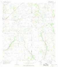
Duette stands as the primary settlement in this mid-century Florida interior, marking a landscape where agricultural drainage and natural hydrology meet. The western portion of the map is defined by the North Fork Manatee River, which snakes through low-lying terrain characterized by numerous small ponds and depressions. To the east, the drainage of Horse Creek and its tributary, West Fork Horse Creek, create a distinct corridor through the flatlands. This 1956 survey, compiled from 1951 aerial photography, documents the region before significant modern development, showing the straddling of the Manatee Co Hardee Co boundary. The land use appears focused on the higher, drier ground between the extensive wetland networks, with a simple road system connecting the scattered farmsteads and rural homesites of the era.
Find a feature on this map
5 named features on this map. Tap any name to fly to it.
Don’t see what you’re looking for? This feature index may not catch every label — zoom into the map to look around manually.
Map Details
Editions of this 1956 Duette Map
5 editions found
Other maps of this area

1955 · Ft. Green
USGS Topo · 1:24,000

1955 · Baird
USGS Topo · 1:24,000

1956 · Ona
USGS Topo · 1:24,000

1956 · Myakka City NW
USGS Topo · 1:24,000

1956 · Ft Lonesome
USGS Topo · 1:24,000

1956 · Myakka Head
USGS Topo · 1:24,000

1956 · Duette NE
USGS Topo · 1:24,000

1956 · Keentown
USGS Topo · 1:24,000

1956 · Tampa
USGS Topo · 1:250,000

1956 · Fort Pierce
USGS Topo · 1:250,000