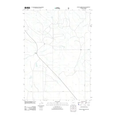
2012 Map of Dugout Creek South
USGS Topo · Published 2012About this map
Dilts Ranch and Steinle Ranch anchor this landscape in Converse County, where the network of ephemeral waterways defines the region's character. The Dry Fork Cheyenne River winds across the central territory, joined by Dugout Creek and the starkly named Calamity Gulch. This 2012 survey illustrates the modern ranching infrastructure of eastern Wyoming, showing how large family holdings are interconnected by a sparse grid of roads like Steinle Rd and Usfs 961. The drainage patterns and topographic contours reveal a high-plains environment where water is the primary sculptor of the land, dictating the placement of outbuildings and corridors of travel through the river valleys.
Find a feature on this map
7 named features on this map. Tap any name to fly to it.
Don’t see what you’re looking for? This feature index may not catch every label — zoom into the map to look around manually.
Map Details
Editions of this 2012 Dugout Creek South Map
This is the sole edition of this map. No revisions or reprints were ever made.
Other maps of this area

1955 · Newcastle
USGS Topo · 1:250,000

1958 · Newcastle
USGS Topo · 1:250,000

1959 · Bill
USGS Topo · 1:62,500

1959 · Betty Reservoir
USGS Topo · 1:62,500

1970 · Bill 4 NW
USGS Topo · 1:24,000

1971 · Coal Bank Draw
USGS Topo · 1:24,000

1971 · Tin Can Lake
USGS Topo · 1:24,000

1979 · Bill
USGS Topo · 1:100,000
1984 · Dugout Creek North
USGS Topo · 1:24,000
1984 · Patsy Draw
USGS Topo · 1:24,000