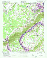
1947 Map of Dunaway Mountain
USGS Topo · Published 1973About this map
The H Neely Henry Lake section of the Coosa River dominates this 1947 landscape, later updated in 1972 to reflect the evolving shoreline and residential growth near Gadsden. The terrain is defined by the prominent ridge of Dunaway Mountain, which separates the river valley from the inland settlements of Rainbow City and Old Harmony. This map captures a period of transition as aviation infrastructure like the Gadsden Municipal Airport and a smaller Landing Strip appear alongside traditional rural landmarks. Genealogists can trace local family and community centers through numerous country churches, such as Friendship Ch and Union Hall Ch, as well as the Kilgrims Rest Sch and Pilgrims Rest Cem in the Southside area. The Southern railroad line and a significant Pipe Line corridor further illustrate the region's mid-century industrial and transport development.
Find a feature on this map
35 named features on this map. Tap any name to fly to it.
Don’t see what you’re looking for? This feature index may not catch every label — zoom into the map to look around manually.
Map Details
Editions of this 1947 Dunaway Mountain Map
3 editions found

Other maps of this area

1885 · Gadsden
USGS Topo · 1:125,000

1888 · Gadsden
USGS Topo · 1:125,000

1889 · Springville
USGS Topo · 1:125,000

1892 · Springville
USGS Topo · 1:125,000

1892 · Gadsden
USGS Topo · 1:125,000

1893 · Fort Payne
USGS Topo · 1:125,000

1895 · Gadsden
USGS Topo · 1:125,000

1898 · Fort Payne
USGS Topo · 1:125,000

1900 · Fort Payne
USGS Topo · 1:125,000

1900 · Anniston
USGS Topo · 1:125,000