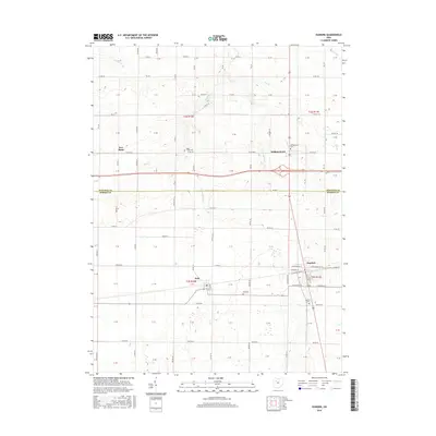
2016 Map of Dunkirk
USGS Topo · Published 2016About this map
Dunkirk and Dola anchor this survey of the boundary between Hancock and Hardin Counties. The terrain is defined by a dense network of water management features, including the Hydraulic Ditch and Woodruff Ditch, alongside natural waterways like Eagle Cr and Hog Cr. This landscape reflects the agricultural heritage of the region, where drainage infrastructure was essential for the development of farmsteads and small crossroads communities. Genealogists will find the area's burial grounds well-documented, from the Dunkirk Cem at the southern edge of town to the Eagle Creek Cem near New Stark. The map also captures the layout of Williamstown, situated at a key highway junction north of the county line, showing the grid of residential streets like W Patterson St and E Geneva St that characterize these small Ohio settlements.
Find a feature on this map
41 named features on this map. Tap any name to fly to it.
Don’t see what you’re looking for? This feature index may not catch every label — zoom into the map to look around manually.
Map Details
Editions of this 2016 Dunkirk Map
This is the sole edition of this map. No revisions or reprints were ever made.
Other maps of this area

1905 · Arlington
USGS Topo · 1:62,500

1907 · Bluffton
USGS Topo · 1:62,500

1907 · Arlington
USGS Topo · 1:24,000

1913 · Alger
USGS Topo · 1:48,000

1915 · Alger
USGS Topo · 1:62,500

1915 · Kenton
USGS Topo · 1:62,500

1943 · Alger
USGS Topo · 1:62,500

1944 · Kenton
USGS Topo · 1:62,500

1950 · Marion
USGS Topo · 1:250,000

1960 · Rawson
USGS Topo · 1:24,000