
1960 Map of Rawson
USGS Topo · Published 1961About this map
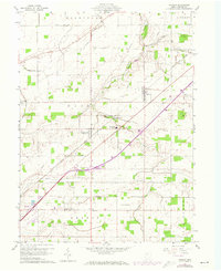
The village of Rawson sits at the intersection of local rail and agricultural interests in this mid-century portrait of Hancock County. The New York Chicago and St Louis railroad serves as a primary corridor through the terrain, connecting Mount Cory and the outlying area of Youngstown. This era is defined by a transition toward modern education and infrastructure, evidenced by the central Cory-Rawson High Sch and a series of pipelines and radio range stations that cross the landscape.
Find a feature on this map
29 named features on this map. Tap any name to fly to it.
Don’t see what you’re looking for? This feature index may not catch every label — zoom into the map to look around manually.
Map Details
Editions of this 1960 Rawson Map
2 editions found
Other maps of this area

1903 · Findlay
USGS Topo · 1:62,500

1905 · Arlington
USGS Topo · 1:62,500

1907 · Bluffton
USGS Topo · 1:62,500

1907 · Arlington
USGS Topo · 1:24,000

1950 · Marion
USGS Topo · 1:250,000

1956 · Toledo
USGS Topo · 1:250,000

1960 · Bluffton
USGS Topo · 1:24,000

1960 · Arlington
USGS Topo · 1:24,000
1960 · Leipsic
USGS Topo · 1:24,000
1960 · Findlay
USGS Topo · 1:24,000