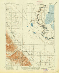
1907 Map of Dunnigan
USGS Topo · Published 1948About this map
The Sacramento River meanders through a landscape defined by river navigation and early rail infrastructure at the beginning of the 20th century. The waterway is lined with historic riverboat stops, including Cranmore Landing, Boyer's Landing, and Poffenbergers Landing, reflecting an era when the river served as a primary commercial artery for agricultural transport. Inland, the arrival of the Southern Pacific and the Woodland Line shifted the economic gravity toward railroad towns.
Find a feature on this map
57 named features on this map. Tap any name to fly to it.
Don’t see what you’re looking for? This feature index may not catch every label — zoom into the map to look around manually.
Map Details
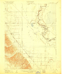
Editions of this 1907 Dunnigan Map
3 editions found
Other maps of this area

1888 · Marysville
USGS Topo · 1:125,000

1891 · Marysville
USGS Topo · 1:125,000

1894 · Marysville
USGS Topo · 1:125,000

1895 · Marysville
USGS Topo · 1:125,000

1905 · Harrington
USGS Topo · 1:24,000

1905 · Esparto
USGS Topo · 1:24,000

1907 · Dunnigan
USGS Topo · 1:62,500

1907 · Colusa
USGS Topo · 1:62,500

1907 · Woodland
USGS Topo · 1:62,500

1907 · Davisville
USGS Topo · 1:62,500