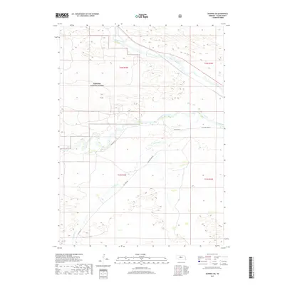
2017 Map of Dunning SW
USGS Topo · Published 2017About this map
The Middle Loup River flows through the northern reaches of this Blaine County landscape, defining the hydrology of the Nebraska Sandhills. Southward, the Dismal River carves a path through the terrain, accompanied by the Dismal River Rd, which serves as a primary transit corridor through this sparsely populated area. The map illustrates the extensive boundaries of the Nebraska National Forest, highlighting the unique reforestation efforts in this prairie region. Ranch roads such as Wild Horse Rd and Wild Horse Creek Rd track alongside the seasonal Wild Horse Cr, tracing the limited infrastructure that supports the local livestock industry and land management within the forest and surrounding townships.
Find a feature on this map
11 named features on this map. Tap any name to fly to it.
Don’t see what you’re looking for? This feature index may not catch every label — zoom into the map to look around manually.
Map Details
Editions of this 2017 Dunning SW Map
This is the sole edition of this map. No revisions or reprints were ever made.
Other maps of this area

1948 · Linscott
USGS Topo · 1:62,500

1948 · Halsey
USGS Topo · 1:62,500

1950 · Linscott
USGS Topo · 1:62,500

1950 · Halsey
USGS Topo · 1:62,500

1951 · Dunning
USGS Topo · 1:62,500

1951 · Hoagland
USGS Topo · 1:62,500

1954 · North Platte
USGS Topo · 1:250,000

1956 · North Platte
USGS Topo · 1:250,000

1957 · North Platte
USGS Topo · 1:250,000

1967 · North Platte
USGS Topo · 1:250,000