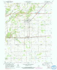
1970 Map of Dunreith
USGS Topo · Published 1982About this map
National Road and the parallel tracks of Conrail anchor the settlement patterns of this section of east-central Indiana. The village of Dunreith sits at a critical junction where these primary east-west corridors meet the Norfolk and Western line, illustrating the historical importance of rail and road transport in Henry County. To the north, Spiceland and Greensboro are surrounded by a landscape divided by the Blue River and Buck Creek.
Find a feature on this map
26 named features on this map. Tap any name to fly to it.
Don’t see what you’re looking for? This feature index may not catch every label — zoom into the map to look around manually.
Map Details
Editions of this 1970 Dunreith Map
3 editions found
Other maps of this area

1948 · Lewisville
USGS Topo · 1:24,000

1949 · New Castle West
USGS Topo · 1:24,000

1950 · New Castle East
USGS Topo · 1:24,000

1950 · Dunreith
USGS Topo · 1:24,000

1950 · Lewisville
USGS Topo · 1:24,000

1953 · Cincinnati
USGS Topo · 1:250,000

1957 · Cincinnati
USGS Topo · 1:250,000

1959 · Mays
USGS Topo · 1:24,000

1959 · Falmouth
USGS Topo · 1:24,000

1960 · New Castle West
USGS Topo · 1:24,000