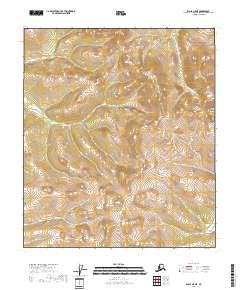
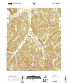
2018 Map of Eagle A-5 NE
USGS Topo · Published 2018About this map
Mt Veta dominates the eastern edge of this terrain in the Southeast Fairbanks Census Area, rising as a prominent landmark amidst the high-elevation drainage basins of the Alaska interior. The landscape is defined by the headwaters of Gold Bottom Cr in the northeast and Norvell Cr in the southwest, illustrating a complex network of ridgelines and steep valleys. This map highlights the transition between several township and range boundaries, including t8s r23e, t8s r24e, t28n r12e, and t27n r12e. The lack of road infrastructure or named settlements underscore the wilderness character of this region during the early twenty-first century, where topographic relief and watercourses provide the primary points of orientation for surveyors and backcountry travelers.
Find a feature on this map
9 named features on this map. Tap any name to fly to it.
Don’t see what you’re looking for? This feature index may not catch every label — zoom into the map to look around manually.
Map Details
Editions of this 2018 Eagle A-5 NE Map
This is the sole edition of this map. No revisions or reprints were ever made.
Other maps of this area

1951 · Eagle
USGS Topo · 1:250,000

1956 · Eagle A-5
USGS Topo · 1:63,360

1956 · Eagle B-5
USGS Topo · 1:63,360

1956 · Eagle B-4
USGS Topo · 1:63,360

1956 · Eagle A-4
USGS Topo · 1:63,360

1957 · Eagle
USGS Topo · 1:250,000
2018 · Eagle A-5 SE
USGS Topo · 1:25,000
2018 · Eagle A-4 NW
USGS Topo · 1:25,000
2018 · Eagle A-5 SW
USGS Topo · 1:25,000
2018 · Eagle B-4 SW
USGS Topo · 1:25,000