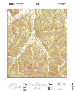
2018 Map of Eagle B-4 SW
USGS Topo · Published 2018About this map
The Middle Fork Fortymile River cuts through the northwest corner of this terrain, anchoring a drainage system that has historically drawn interest for its mineral potential. The landscape is defined by high ridgelines and the deeply incised valleys of McKinley Cr and Little Whiteman Cr, which flow generally northward. These watercourses are part of a larger network of tributaries, including Gold Bottom Cr and Silver Bow Cr, whose names reflect the prospecting history that once saturated this region of Alaska. The map illustrates a wilderness largely devoid of modern structures or roads, focusing instead on the hydrography and elevation contours that guided early travelers and miners through the interior. Smaller tributaries like Enterprise Cr and Van Milligan Cr further delineate the complex topography of the southeast Fairbanks census area, providing a clear view of the natural corridors used for navigation before the era of modern infrastructure.
Find a feature on this map
15 named features on this map. Tap any name to fly to it.
Don’t see what you’re looking for? This feature index may not catch every label — zoom into the map to look around manually.
Map Details
Editions of this 2018 Eagle B-4 SW Map
This is the sole edition of this map. No revisions or reprints were ever made.
Other maps of this area

1951 · Eagle
USGS Topo · 1:250,000

1956 · Eagle A-5
USGS Topo · 1:63,360

1956 · Eagle B-5
USGS Topo · 1:63,360

1956 · Eagle B-4
USGS Topo · 1:63,360

1956 · Eagle A-4
USGS Topo · 1:63,360

1957 · Eagle
USGS Topo · 1:250,000
2018 · Eagle B-4 NW
USGS Topo · 1:25,000
2018 · Eagle B-5 NE
USGS Topo · 1:25,000

2018 · Eagle A-4 NW
USGS Topo · 1:25,000
2018 · Eagle B-5 SE
USGS Topo · 1:25,000