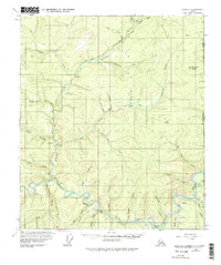
1956 Map of Eagle B-1
USGS Topo · Published 1975About this map
The Fortymile River carves through this remote interior landscape during the mid-1950s, serving as the primary drainage for a network of creeks including O'Brien Creek, Liberty Fork, and Steele Creek. The region’s economic life is centered on mineral extraction, evidenced by several Placer Mines and the Dome Creek Mine. Infrastructure is minimal and rugged, defined by the Taylor Highway and seasonal access points like the Landing Strip (Winter).
Find a feature on this map
49 named features on this map. Tap any name to fly to it.
Don’t see what you’re looking for? This feature index may not catch every label — zoom into the map to look around manually.
Map Details
Editions of this 1956 Eagle B-1 Map
3 editions found
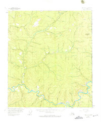
Other maps of this area

1899 · Fortymile
USGS Topo · 1:250,000

1951 · Eagle
USGS Topo · 1:250,000

1956 · Eagle C-1
USGS Topo · 1:63,360

1956 · Eagle C-2
USGS Topo · 1:63,360

1956 · Eagle A-1
USGS Topo · 1:63,360

1956 · Eagle B-2
USGS Topo · 1:63,360

1956 · Eagle A-2
USGS Topo · 1:63,360

1956 · Eagle B-1
USGS Topo · 1:63,360

1957 · Eagle
USGS Topo · 1:250,000
2018 · Eagle A-1 NW
USGS Topo · 1:25,000