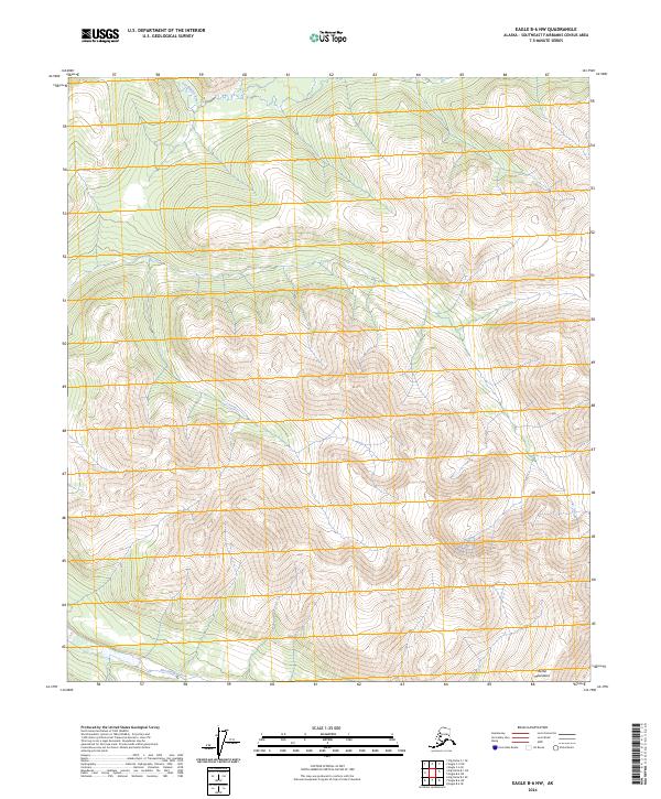
2024 Map of Eagle B-6 NW
USGS Topo · Published 2024About this map
Mertie Mountains dominate the southern landscape of this interior Alaskan quadrangle, defining a high-elevation terrain where deep drainages feed the surrounding river systems. In the north, the Goodpaster River carves a winding path through the topography, while the southern reaches are marked by the headwaters of the Eisenmenger Fork. This 2024 survey reflects a region primarily characterized by its natural watercourses and significant elevation changes, with no established roads or settlements printed on the sheet. The map provides a precise record of the Public Land Survey System (PLSS) grid, including sections of t5s r19e and t6s r20e, which assist in locating specific geographical points within this undeveloped portion of the Southeast Fairbanks Census Area.
Find a feature on this map
7 named features on this map. Tap any name to fly to it.
Don’t see what you’re looking for? This feature index may not catch every label — zoom into the map to look around manually.
Map Details
Editions of this 2024 Eagle B-6 NW Map
This is the sole edition of this map. No revisions or reprints were ever made.
Other maps of this area

1950 · Big Delta
USGS Topo · 1:250,000

1951 · Big Delta
USGS Topo · 1:250,000

1951 · Eagle
USGS Topo · 1:250,000

1956 · Eagle C-6
USGS Topo · 1:63,360

1956 · Eagle B-6
USGS Topo · 1:63,360

1957 · Eagle
USGS Topo · 1:250,000

1958 · Big Delta B-1
USGS Topo · 1:63,360

1958 · Big Delta C-1
USGS Topo · 1:63,360

1958 · Big Delta
USGS Topo · 1:250,000
2018 · Big Delta C-1 SE
USGS Topo · 1:25,000