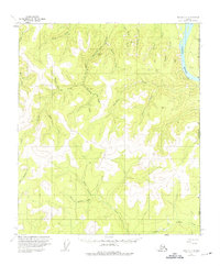
1956 Map of Eagle C-1
USGS Topo · Published 1975About this map
The Yukon River carves through the eastern edge of this landscape, marking the international boundary between the Alaska Yukon and the United States Canada border. Inland, the Taylor Highway winds through a complex network of gold-bearing drainages, providing access to remote outposts like the Gravel Gulch Shelter Cabin. The terrain is defined by a dense system of forks and gulches, many bearing names that hint at the region's mining heritage, including Discovery Fork, Star Gulch, King Solomon Creek, and Queen of Sheba Creek. While the American Creek Campground offers a rare point of modern recreation, the presence of several isolated Cabins and surveying benchmarks like VABM George and VABM Plateau underscores the vast, unpopulated nature of this subarctic wilderness in the mid-1950s.
Find a feature on this map
32 named features on this map. Tap any name to fly to it.
Don’t see what you’re looking for? This feature index may not catch every label — zoom into the map to look around manually.
Map Details
Editions of this 1956 Eagle C-1 Map
2 editions found
Other maps of this area

1899 · Fortymile
USGS Topo · 1:250,000

1951 · Eagle
USGS Topo · 1:250,000

1956 · Eagle C-1
USGS Topo · 1:63,360

1956 · Eagle D-2
USGS Topo · 1:63,360

1956 · Eagle C-2
USGS Topo · 1:63,360

1956 · Eagle B-2
USGS Topo · 1:63,360
1956 · Eagle D-1
USGS Topo · 1:63,360

1956 · Eagle B-1
USGS Topo · 1:63,360

1957 · Eagle
USGS Topo · 1:250,000
2018 · Eagle D-2 SE
USGS Topo · 1:25,000