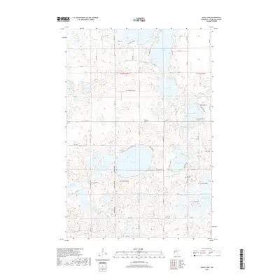
2019 Map of Eagle Lake
USGS Topo · Published 2019About this map
Eagle Lake and its surrounding wetlands define this portion of Otter Tail County, where a dense network of glacial basins has shaped local settlement patterns and transportation. The landscape is dotted with small, family and community burial grounds including Eagle Lake Cem, Evander Cem, and Grue Cem, reflecting the area's deep-rooted rural heritage. These sites are often found near the shores of significant water bodies like Clitherall Lake and Crane Lake, which dominate the northern half of the region.
Find a feature on this map
51 named features on this map. Tap any name to fly to it.
Don’t see what you’re looking for? This feature index may not catch every label — zoom into the map to look around manually.
Map Details
Editions of this 2019 Eagle Lake Map
This is the sole edition of this map. No revisions or reprints were ever made.
Other maps of this area

1912 · Battle Lake
USGS Topo · 1:62,500

1913 · Ashby
USGS Topo · 1:62,500

1914 · Battle Lake
USGS Topo · 1:62,500

1915 · Underwood
USGS Topo · 1:62,500

1953 · Brainerd
USGS Topo · 1:250,000

1957 · Brainerd
USGS Topo · 1:250,000

1958 · Brainerd
USGS Topo · 1:250,000

1965 · Brainerd
USGS Topo · 1:250,000

1969 · Eagle Lake
USGS Topo · 1:24,000
1969 · Millerville
USGS Topo · 1:24,000
Featured Places
- Eagle Lake Township, MN
- Leaf Mountain Township, MN
- Clitherall Township, MN
- Nidaros Township, MN
- Otter Tail County, MN