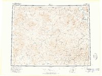
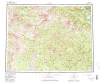
1957 Map of Eagle
USGS Topo · Published 1966About this map
The Yukon River and the international border between the United States and Canada define this vast interior landscape during the mid-1950s. Settlement is concentrated along river corridors and the newly accessible Taylor Highway, which connects remote outposts like Chicken, Franklin, and Jack Wade to the wider territory. The map documents the historic gateway of Eagle and the adjacent Eagle Village at the confluence of the Yukon and Mission Creek, a region shaped by gold rushes and subsistence living.
Find a feature on this map
87 named features on this map. Tap any name to fly to it.
Don’t see what you’re looking for? This feature index may not catch every label — zoom into the map to look around manually.
Map Details
Editions of this 1957 Eagle Map
6 editions found

Other maps of this area

1899 · Fortymile
USGS Topo · 1:250,000

1949 · Tanacross
USGS Topo · 1:250,000

1950 · Tanacross
USGS Topo · 1:250,000

1950 · Mount Hayes
USGS Topo · 1:250,000

1950 · Big Delta
USGS Topo · 1:250,000

1951 · Big Delta
USGS Topo · 1:250,000

1951 · Mount Hayes
USGS Topo · 1:250,000

1951 · Charley River
USGS Topo · 1:250,000

1951 · Eagle
USGS Topo · 1:250,000

1951 · Circle
USGS Topo · 1:250,000