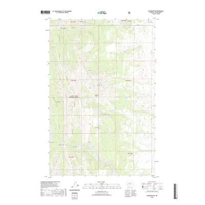
2020 Map of Ear Mountain
USGS Topo · Published 2020About this map
The Lewis & Clark National Forest dominates this section of the Sawtooth Range in Teton County, where high peaks and deep drainage systems define the physical landscape. Landmarks such as Ear Mtn, Chute Mtn, and Wind Mtn rise sharply above the surrounding gulches, while the S Fork Teton River flows along the northern edge of the survey.
Find a feature on this map
34 named features on this map. Tap any name to fly to it.
Don’t see what you’re looking for? This feature index may not catch every label — zoom into the map to look around manually.
Map Details
Editions of this 2020 Ear Mountain Map
This is the sole edition of this map. No revisions or reprints were ever made.
Other maps of this area

1903 · Saypo
USGS Topo · 1:125,000

1955 · Choteau
USGS Topo · 1:250,000

1957 · Choteau
USGS Topo · 1:250,000

1958 · Choteau
USGS Topo · 1:250,000

1958 · Ear Mountain
USGS Topo · 1:24,000

1958 · Lake Theboe
USGS Topo · 1:24,000

1958 · Cave Mountain
USGS Topo · 1:24,000

1958 · Mount Wright
USGS Topo · 1:24,000
1958 · Twin Lakes
USGS Topo · 1:24,000

1958 · Our Lake
USGS Topo · 1:24,000