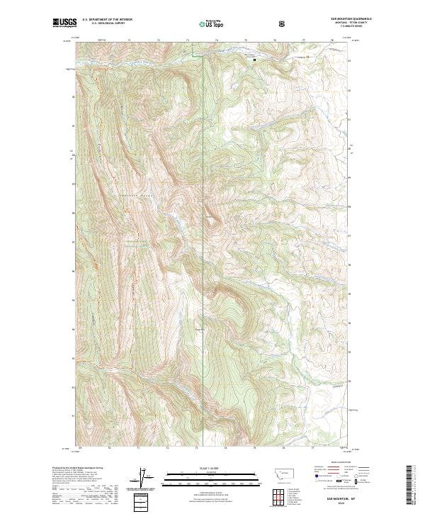
2024 Map of Ear Mountain
USGS Topo · Published 2024About this map
The Sawtooth Range defines this landscape where the high peaks of the Front Range meet the western edge of the Great Plains. This 2024 survey documents a critical wilderness boundary, showcasing the overlap of the Bob Marshall Wilderness and the Lewis & Clark National Forest. The presence of the Metis Cem in the northern canyon of the South Fork Teton River provides a rare genealogical marker in a terrain otherwise dominated by physical geography. The map reveals an intricate network of drainage systems, including North Fork Willow Creek and South Fork Willow Creek, which flow eastward from landmarks like Ear Mtn and Chute Mtn. Backcountry access is traced through the Rierdon Gulch Trl and North Fork Deep Creek Trl, showing how contemporary recreation and conservation areas like the Blackfoot Valley Conservation Area interface with historic mountain passes.
Find a feature on this map
32 named features on this map. Tap any name to fly to it.
Don’t see what you’re looking for? This feature index may not catch every label — zoom into the map to look around manually.
Map Details
Editions of this 2024 Ear Mountain Map
This is the sole edition of this map. No revisions or reprints were ever made.
Other maps of this area

1903 · Saypo
USGS Topo · 1:125,000

1955 · Choteau
USGS Topo · 1:250,000

1957 · Choteau
USGS Topo · 1:250,000

1958 · Choteau
USGS Topo · 1:250,000

1958 · Ear Mountain
USGS Topo · 1:24,000

1958 · Lake Theboe
USGS Topo · 1:24,000

1958 · Cave Mountain
USGS Topo · 1:24,000

1958 · Mount Wright
USGS Topo · 1:24,000
1958 · Twin Lakes
USGS Topo · 1:24,000

1958 · Our Lake
USGS Topo · 1:24,000