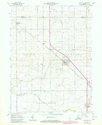
1962 Map of Earl Park
USGS Topo · Published 1980About this map
Earl Park serves as the central hub of this agricultural landscape in northwestern Indiana, where the grid of rural township roads meets the vital path of the Conrail line. The community is anchored by civic and religious landmarks, including the Earl Park Cem and St John Cem situated on the outskirts of town. Farther north, the small settlement of Raub maintains its own local identity with the Township Sch, while Sheff marks a specific point of interest along the railroad corridor.
Find a feature on this map
20 named features on this map. Tap any name to fly to it.
Don’t see what you’re looking for? This feature index may not catch every label — zoom into the map to look around manually.
Map Details
Editions of this 1962 Earl Park Map
2 editions found

Other maps of this area

1935 · Watseka
USGS Topo · 1:48,000

1938 · Milford
USGS Topo · 1:48,000

1939 · Watseka
USGS Topo · 1:62,500

1944 · Milford
USGS Topo · 1:62,500

1953 · Danville
USGS Topo · 1:250,000

1955 · Danville
USGS Topo · 1:250,000

1956 · Danville
USGS Topo · 1:250,000

1961 · Kentland
USGS Topo · 1:24,000

1962 · Wadena
USGS Topo · 1:24,000

1962 · Boswell
USGS Topo · 1:24,000