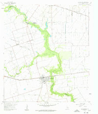
1960 Map of East Bernard
USGS Topo · Published 1961About this map
The San Bernard River and its meandering tributaries, including Middle Bernard Creek and Eagle Branch, define this pocket of the Texas Gulf Coast at the start of the 1960s. The landscape transitions from the broad Bernard Prairie to riparian bottomlands, marked by a dense network of drainage and irrigation features such as the Chesterville Line Canal. Settlement is anchored by East Bernard and Wallis, which serve as focal points for the region's agricultural and rail-dependent economy.
Find a feature on this map
30 named features on this map. Tap any name to fly to it.
Don’t see what you’re looking for? This feature index may not catch every label — zoom into the map to look around manually.
Map Details
Editions of this 1960 East Bernard Map
3 editions found
Other maps of this area

1950 · Houston
USGS Topo · 1:250,000

1952 · Egypt
USGS Topo · 1:24,000

1953 · Kendleton
USGS Topo · 1:24,000

1953 · Hungerford
USGS Topo · 1:24,000

1953 · Seguin
USGS Topo · 1:250,000

1955 · Richmond
USGS Topo · 1:62,500

1956 · Wallis
USGS Topo · 1:62,500

1956 · Houston
USGS Topo · 1:250,000

1958 · Seguin
USGS Topo · 1:250,000

1960 · Lissie
USGS Topo · 1:24,000