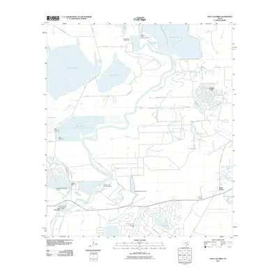
2010 Map of East Columbia
USGS Topo · Published 2010About this map
The Brazos River meanders through this landscape, defining a region rich with oxbow lakes and water management infrastructure at the start of the 21st century. The East Columbia Historic District marks a significant cultural site near the riverbank, reflecting the deep-rooted settlement history of Brazoria County. To the northeast, the community of Holiday Lakes sits amidst a cluster of water bodies including Snag Lake and Horseshoe Lake, illustrating a residential pattern integrated with the natural bayous and creeks. Extensive flood control is evident through numerous structures such as the Griffith Reservoir Levee, Black Ranch Lake Levee, and Bintliff Lake Levee. These features, along with the William Harris Reservoir and Harris Reservoir, demonstrate the complex relationship between the local agricultural economy and the river's floodplain. Researchers can also locate the Munson Cemetery and the settlement of Bailey Prairie near the eastern margins.
Find a feature on this map
63 named features on this map. Tap any name to fly to it.
Don’t see what you’re looking for? This feature index may not catch every label — zoom into the map to look around manually.
Map Details
Editions of this 2010 East Columbia Map
This is the sole edition of this map. No revisions or reprints were ever made.
Other maps of this area

1943 · Rosharon
USGS Topo · 1:31,680

1943 · Angleton
USGS Topo · 1:24,000

1943 · Snipe
USGS Topo · 1:31,680

1950 · Houston
USGS Topo · 1:250,000

1952 · West Columbia
USGS Topo · 1:24,000

1952 · Sweeny
USGS Topo · 1:24,000

1952 · East Columbia
USGS Topo · 1:24,000

1952 · Brazoria
USGS Topo · 1:24,000

1953 · Damon
USGS Topo · 1:24,000

1953 · Otey
USGS Topo · 1:24,000
Featured Places
- Holiday Lakes, TX
- Bailey's Prairie, TX
- East Columbia, TX
- Bailey Prairie, Bailey's Prairie
- Brazoria County, TX