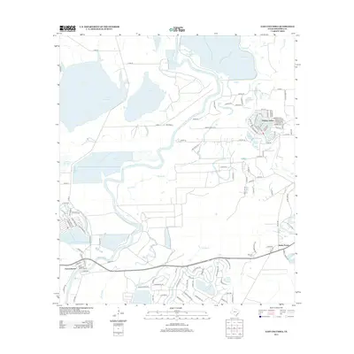
2013 Map of East Columbia
USGS Topo · Published 2013About this map
The Brazos River meanders through this portion of Brazoria County, defining a landscape dominated by oxbow lakes and managed reservoirs. At the southern bend of the river, the East Columbia Historic District preserves the footprint of one of Texas's earliest river ports, once a vital gateway for inland trade. To the north, the modern residential layout of Holiday Lakes surrounds a cluster of water bodies including Snag Lake and Horseshoe Lake, illustrating the transition of the river's floodplains into developed recreational and residential communities.
Find a feature on this map
130 named features on this map. Tap any name to fly to it.
Don’t see what you’re looking for? This feature index may not catch every label — zoom into the map to look around manually.
Map Details
Editions of this 2013 East Columbia Map
This is the sole edition of this map. No revisions or reprints were ever made.
Other maps of this area

1943 · Rosharon
USGS Topo · 1:31,680

1943 · Angleton
USGS Topo · 1:24,000

1943 · Snipe
USGS Topo · 1:31,680

1950 · Houston
USGS Topo · 1:250,000

1952 · West Columbia
USGS Topo · 1:24,000

1952 · Sweeny
USGS Topo · 1:24,000

1952 · East Columbia
USGS Topo · 1:24,000

1952 · Brazoria
USGS Topo · 1:24,000

1953 · Damon
USGS Topo · 1:24,000

1953 · Otey
USGS Topo · 1:24,000
Featured Places
- Holiday Lakes, TX
- Bailey's Prairie, TX
- East Columbia, TX
- Bailey Prairie, Bailey's Prairie
- Brazoria County, TX