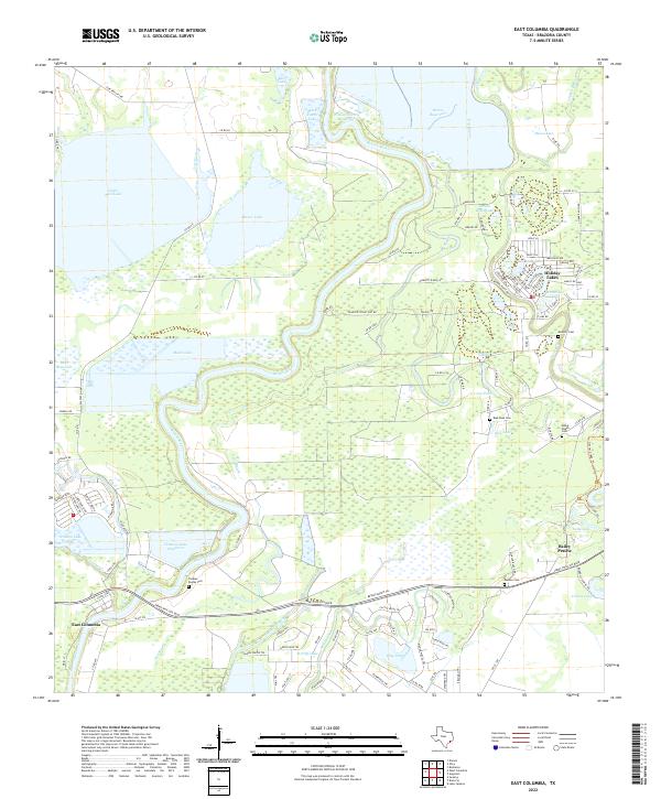
2022 Map of East Columbia
USGS Topo · Published 2022About this map
The Brazos River snakes through a landscape defined by oxbow lakes and coastal prairie, anchoring the historic settlement of East Columbia in the southwestern quadrant. This modern record reveals a territory shaped by water, where numerous named basins like Eagle Nest Lake, Manor Lake, and Mann Lake represent remnants of the river's shifting course. The distribution of family and community burial grounds, including Thomas Dumas Cem, Munson Cem, and Blue Lake Cem, offers a detailed map for genealogists tracing the legacy of Brazoria County families.
Find a feature on this map
126 named features on this map. Tap any name to fly to it.
Don’t see what you’re looking for? This feature index may not catch every label — zoom into the map to look around manually.
Map Details
Editions of this 2022 East Columbia Map
This is the sole edition of this map. No revisions or reprints were ever made.
Other maps of this area

1943 · Rosharon
USGS Topo · 1:31,680

1943 · Angleton
USGS Topo · 1:24,000

1943 · Snipe
USGS Topo · 1:31,680

1950 · Houston
USGS Topo · 1:250,000

1952 · West Columbia
USGS Topo · 1:24,000

1952 · Sweeny
USGS Topo · 1:24,000

1952 · East Columbia
USGS Topo · 1:24,000

1952 · Brazoria
USGS Topo · 1:24,000

1953 · Damon
USGS Topo · 1:24,000

1953 · Otey
USGS Topo · 1:24,000
Featured Places
- Holiday Lakes, TX
- Bailey's Prairie, TX
- East Columbia, TX
- Bailey Prairie, Bailey's Prairie
- Brazoria County, TX