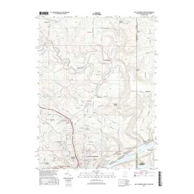
2016 Map of East Liverpool North
USGS Topo · Published 2016About this map
East Liverpool and its industrial northern outskirts are centered at the complex confluence of the Ohio River and Little Beaver Creek. This 2016 survey illustrates a landscape shaped by both early industry and conservation, where the rugged topography around Sheepskin Hollow and Purgatory Hollow remains largely undeveloped despite the proximity to manufacturing hubs. The map reveals a high density of sites for local history and genealogy, from established burial grounds like Riverview Cem and Bnai Jacob Cem to the modern educational footprint of the Ohio Valley Coll of Technology. While the southern edge is dominated by the urban grid of Pleasant Heights and East End, the northern sections near Fredericktown and Clarkson maintain a more rural character. Extensive recreational paths, including the N Country National Scenic Trail and the Vondergreen Trail, wind through the wooded hillsides that overlook the river valley, marking a transition from the commercial riverfront to protected natural corridors.
Find a feature on this map
238 named features on this map. Tap any name to fly to it.
Don’t see what you’re looking for? This feature index may not catch every label — zoom into the map to look around manually.
Map Details
Editions of this 2016 East Liverpool North Map
This is the sole edition of this map. No revisions or reprints were ever made.
Other maps of this area

1901 · Beaver
USGS Topo · 1:62,500

1902 · New Castle
USGS Topo · 1:62,500

1904 · Newcastle
USGS Topo · 1:62,500

1904 · Wellsville
USGS Topo · 1:62,500

1904 · Beaver
USGS Topo · 1:62,500

1907 · Columbiana
USGS Topo · 1:62,500

1909 · Columbiana
USGS Topo · 1:62,500

1937 · Wellsville
USGS Topo · 1:62,500

1944 · Wellsville
USGS Topo · 1:62,500

1951 · Canton
USGS Topo · 1:250,000