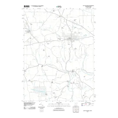
2010 Map of East Palestine
USGS Topo · Published 2010About this map
East Palestine serves as the primary hub of this 2010 survey, where the intersection of Sulphur Run and Leslie Run meet the developed grid of the town. The landscape reveals a transition from these urban centers to the agricultural and orchard lands of Columbiana County, including the Millrock Orchard and Peace Valley Orchards. Genealogical researchers will find a significant concentration of burial sites throughout the township, ranging from the Unity Brick Cemetery in the north to the Achor Valley Cemetery and Mount Zion Cemetery further south.
Find a feature on this map
93 named features on this map. Tap any name to fly to it.
Don’t see what you’re looking for? This feature index may not catch every label — zoom into the map to look around manually.
Map Details
Editions of this 2010 East Palestine Map
This is the sole edition of this map. No revisions or reprints were ever made.
Other maps of this area

1901 · Beaver
USGS Topo · 1:62,500

1902 · New Castle
USGS Topo · 1:62,500

1904 · Newcastle
USGS Topo · 1:62,500

1904 · Wellsville
USGS Topo · 1:62,500

1904 · Beaver
USGS Topo · 1:62,500

1907 · Columbiana
USGS Topo · 1:62,500

1909 · Columbiana
USGS Topo · 1:62,500

1937 · Wellsville
USGS Topo · 1:62,500

1944 · Wellsville
USGS Topo · 1:62,500

1951 · Canton
USGS Topo · 1:250,000