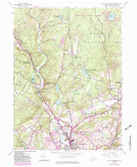
1944 Map of East Stroudsburg
USGS Topo · Published 1983About this map
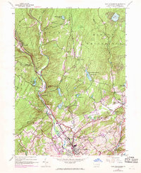
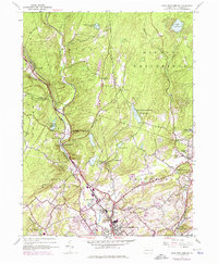
Brodhead Creek carves a deep valley through this portion of Monroe County, serving as a primary corridor for both the water and transportation networks of the era. The settlement of Analomink sits at the junction of several smaller runs, including Butz Run and Poplar Run, while the higher ground to the east is dominated by the Delaware State Forest. The map documents a landscape transitioning from rural farmsteads and mountain schools like Lesoine Sch toward a mid-century infrastructure that includes the Stroudsburg-Pocono Airpark and a Drive-in Theater near Beakleyville.
Find a feature on this map
47 named features on this map. Tap any name to fly to it.
Don’t see what you’re looking for? This feature index may not catch every label — zoom into the map to look around manually.
Map Details
Editions of this 1944 East Stroudsburg Map
6 editions found
Other maps of this area

1891 · Delaware Water Gap
USGS Topo · 1:62,500

1893 · Delaware Water Gap
USGS Topo · 1:62,500

1914 · Wind Gap
USGS Topo · 1:62,500

1916 · Wind Gap
USGS Topo · 1:62,500

1919 · Pocono
USGS Topo · 1:62,500

1921 · Pocono
USGS Topo · 1:62,500

1923 · Pocono
USGS Topo · 1:62,500

1924 · Bushkill
USGS Topo · 1:48,000

1936 · Delaware Water Gap
USGS Topo · 1:48,000

1941 · Delaware Water Gap
USGS Topo · 1:62,500
Featured Places
- Paradise Township, PA
- Analomink, Stroud Township
- Marshalls Creek, Smithfield Township
- Middle Smithfield Township, PA
- Arlington Heights, Stroud Township