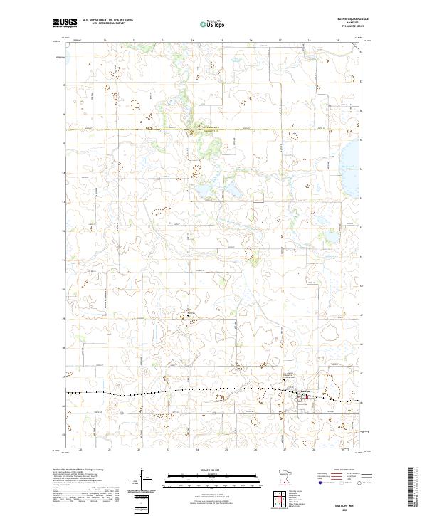
2022 Map of Easton
USGS Topo · Published 2022About this map
Easton serves as the primary hub of this prairie landscape in south-central Minnesota, situated just south of the border between Blue Earth and Faribault counties. The town is surrounded by a highly organized grid of rural roads, including 190th St and 593rd Ave, which provide access to scattered farmsteads and agricultural plots. The hydrology of the region is defined by the winding course of the Maple River and the engineered precision of County Ditch Number Seventythree, illustrating the long-term transformation of wetlands into productive farmland. Genealogy researchers can find significant local landmarks such as Saint Peter's Evangelical Lutheran Cem on the outskirts of town and the more isolated Lura Cem to the northwest. To the northeast, the map shows the edge of Minnesota Lake, while the Big Slough remains a distinctive natural feature within the township grid.
Find a feature on this map
57 named features on this map. Tap any name to fly to it.
Don’t see what you’re looking for? This feature index may not catch every label — zoom into the map to look around manually.
Map Details
Editions of this 2022 Easton Map
This is the sole edition of this map. No revisions or reprints were ever made.
Other maps of this area

1954 · Fairmont
USGS Topo · 1:250,000

1954 · Mason City
USGS Topo · 1:250,000

1955 · Bricelyn
USGS Topo · 1:62,500

1957 · Mason City
USGS Topo · 1:250,000

1958 · Mason City
USGS Topo · 1:250,000

1958 · Fairmont
USGS Topo · 1:250,000

1967 · Minnesota Lake
USGS Topo · 1:24,000
1967 · Mapleton
USGS Topo · 1:24,000
1967 · Easton
USGS Topo · 1:24,000
1967 · Delavan
USGS Topo · 1:24,000