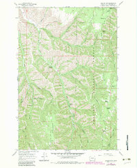
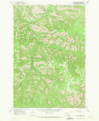
1967 Map of Eckler Mtn
USGS Topo · Published 1983About this map
Umatilla National Forest encompasses the high country of Columbia County, where the North Fork Touchet River and Little Tucannon River carve deep drainage patterns through the landscape. This 1967 survey, with revisions added through the early 1980s, details the remote network of resource roads and springs that supported mountain activity. Prominent landmarks such as Kendall Monument and Mountain Top provide survey control points above the steep descent into Spoonamore Canyon.
Find a feature on this map
36 named features on this map. Tap any name to fly to it.
Don’t see what you’re looking for? This feature index may not catch every label — zoom into the map to look around manually.
Map Details
Editions of this 1967 Eckler Mtn Map
2 editions found
Other maps of this area

1937 · Pomeroy
USGS Topo · 1:96,000

1942 · Pomeroy
USGS Topo · 1:125,000

1955 · Pullman
USGS Topo · 1:250,000

1958 · Pullman
USGS Topo · 1:250,000
1967 · Robinette Mtn.
USGS Topo · 1:24,000

1967 · Hopkins Ridge
USGS Topo · 1:24,000

1967 · Cahill Mtn
USGS Topo · 1:24,000

1967 · Oregon Butte
USGS Topo · 1:24,000
1967 · Dayton
USGS Topo · 1:24,000
1967 · Panjab Creek
USGS Topo · 1:24,000