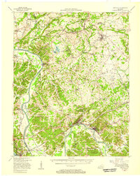
1955 Map of Eddyville
USGS Topo · Published 1957About this map
The Cumberland River carves a deep path through Lyon, Caldwell, and Crittenden Counties in this mid-century survey, a landscape defined by its river-borne history and industrial transition. Long before the dams altered the regional hydrology, the Eddyville Ferry remained a vital crossing point, and the State Penal Farm occupied a prominent position near the riverbank at Eddyville. The map captures the remnants of the area's iron heritage through labels like Suwanee Furnace and Kelly Furnace, alongside active industrial sites such as the Fredonia Valley Quarry.
Find a feature on this map
121 named features on this map. Tap any name to fly to it.
Don’t see what you’re looking for? This feature index may not catch every label — zoom into the map to look around manually.
Map Details
Editions of this 1955 Eddyville Map
This is the sole edition of this map. No revisions or reprints were ever made.
Other maps of this area

1908 · Princeton
USGS Topo · 1:62,500

1909 · Providence
USGS Topo · 1:62,500

1910 · Princeton
USGS Topo · 1:62,500

1916 · Fords Ferry
USGS Topo · 1:62,500

1916 · Golconda
USGS Topo · 1:62,500

1920 · Goloonda
USGS Topo · 1:48,000

1921 · Fords Ferry
USGS Topo · 1:48,000

1921 · Golconda
USGS Topo · 1:62,500

1925 · Cave In Rock
USGS Topo · 1:62,500

1928 · Eddyville
USGS Topo · 1:48,000