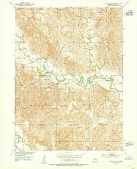
1951 Map of Eddyville NW
USGS Topo · Published 1953About this map
The South Loup River carves a winding path through this portion of Custer County, shaping a landscape defined by its river-and-rail connectivity in the early 1950s. The river's meandering oxbows are a focal point, particularly where they border the Pressey State Recreation Grounds. This public land indicates an early commitment to conservation and recreation within the agricultural heartland of Nebraska. To the south, the Wood River flows parallel, while the Union Pacific railroad line clips the southwestern corner, marking the vital transportation corridor of the era.
Find a feature on this map
14 named features on this map. Tap any name to fly to it.
Don’t see what you’re looking for? This feature index may not catch every label — zoom into the map to look around manually.
Map Details
Editions of this 1951 Eddyville NW Map
3 editions found
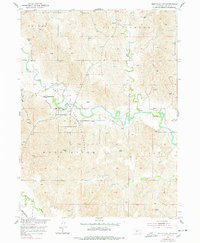
Other maps of this area

1951 · Broken Bow SW
USGS Topo · 1:24,000

1951 · Broken Bow SE
USGS Topo · 1:24,000

1951 · Eddyville NE
USGS Topo · 1:24,000

1951 · Callaway SE
USGS Topo · 1:24,000

1951 · Eddyville NW
USGS Topo · 1:24,000

1951 · Oconto SE
USGS Topo · 1:24,000

1951 · Eddyville
USGS Topo · 1:24,000

1951 · Eddyville SW
USGS Topo · 1:24,000

1951 · Oconto
USGS Topo · 1:24,000

1955 · Broken Bow
USGS Topo · 1:250,000