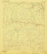
1896 Map of Eden
USGS Topo · Published 1918About this map
Eden stands as the central settlement in this late 19th-century reconnaissance of West Texas, situated where the Edwards Plateau meets the rolling plains. The landscape is defined by the prominent Concho Mountains, a rugged escarpment that divides the northern drainage of the Colorado River from the southern reaches of the San Saba watershed. Surveyed in the 1880s, the map reveals a region organized around its vital water sources, with extensive creek systems like Kickapoo Creek and Brady Creek providing the primary structure for ranching and early commerce. The passage through Salt Gap indicates a natural transit point through the high ground, while numerous family-named or descriptive waterways such as Reubels Creek, Maverick Creek, and Celery Creek reflect the early identification of the land by its first permanent settlers and surveyors. The lack of extensive rail or town development at this date highlights the isolated, frontier character of this portion of Concho, McCulloch, and Menard counties.
Find a feature on this map
26 named features on this map. Tap any name to fly to it.
Don’t see what you’re looking for? This feature index may not catch every label — zoom into the map to look around manually.
Map Details
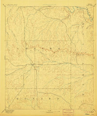
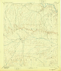
Editions of this 1896 Eden Map
4 editions found

Other maps of this area

1887 · Mason
USGS Topo · 1:125,000

1887 · Coleman
USGS Topo · 1:125,000

1889 · Coleman
USGS Topo · 1:125,000

1891 · Hayrick
USGS Topo · 1:125,000

1892 · San Angelo
USGS Topo · 1:125,000

1892 · Eden
USGS Topo · 1:125,000

1892 · Ballinger
USGS Topo · 1:125,000

1893 · Fort McKavett
USGS Topo · 1:125,000

1894 · Brady
USGS Topo · 1:125,000

1894 · Hayrick
USGS Topo · 1:125,000