
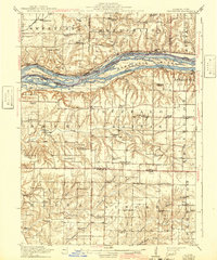
1916 Map of Edgington
USGS Topo · Published 1916About this map
Mississippi River channels and shifting alluvial islands define the northern reach of this 1913 survey, where a complex network of waterways like Andalusia Slough and Wyoming Slough weave around Geneva Island. On the northern bank in Iowa, the Chicago Milwaukee and St Paul Pacific railroad tracks follow the river's edge through Montpelier and Sweetland. To the south in Illinois, the landscape transitions from the river bottoms into a high prairie dissected by deep ravines like Big Hollow. This upland is dotted with early twentieth-century rural schoolhouses, such as Whiteoak School, Buffalo Center School, and New Era, serving the agricultural communities of Illinois City and Edgington. The density of named schools and small post offices like Wrayville offers a detailed view of the localized social and educational infrastructure before the consolidation of rural districts.
Find a feature on this map
69 named features on this map. Tap any name to fly to it.
Don’t see what you’re looking for? This feature index may not catch every label — zoom into the map to look around manually.
Map Details
Editions of this 1916 Edgington Map
3 editions found

Other maps of this area

1890 · Durant
USGS Topo · 1:62,500

1891 · Davenport
USGS Topo · 1:62,500

1891 · Wilton Junction
USGS Topo · 1:62,500

1894 · Durant
USGS Topo · 1:62,500

1894 · Davenport
USGS Topo · 1:62,500

1901 · Rock Island
USGS Topo · 1:125,000

1901 · Stanwood
USGS Topo · 1:125,000

1910 · Rock Island
USGS Topo · 1:125,000

1912 · Milan
USGS Topo · 1:62,500

1923 · Alexis
USGS Topo · 1:62,500