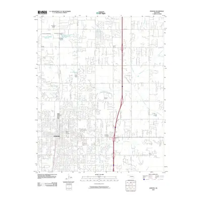
2009 Map of Edmond
USGS Topo · Published 2009About this map
Edmond appears here as a rapidly evolving suburban landscape, dominated by a dense residential grid that spreads outward toward the north and east. The campus of Central State University sits at the heart of the settlement, serving as a major institutional anchor. This 2009 survey highlights the intersection of modern development and the area's older rural foundations, marked by several local burial grounds including Grace Lawn Cemetery, Waterloo Cemetery, and Pleasant Hill Cemetery.
Find a feature on this map
55 named features on this map. Tap any name to fly to it.
Don’t see what you’re looking for? This feature index may not catch every label — zoom into the map to look around manually.
Map Details
Editions of this 2009 Edmond Map
This is the sole edition of this map. No revisions or reprints were ever made.
Other maps of this area

1892 · Guthrie
USGS Topo · 1:62,500

1892 · Edmond
USGS Topo · 1:62,500

1892 · Kingfisher
USGS Topo · 1:125,000

1895 · Kingfisher
USGS Topo · 1:125,000

1935 · Spencer
USGS Topo · 1:24,000

1935 · Edmond
USGS Topo · 1:48,000

1940 · Edmond
USGS Topo · 1:62,500

1951 · Britton
USGS Topo · 1:24,000

1954 · Oklahoma City
USGS Topo · 1:250,000
1955 · Jones
USGS Topo · 1:24,000