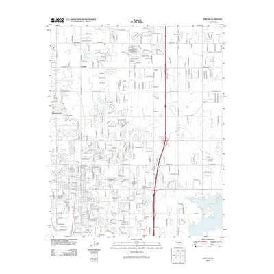
2012 Map of Edmond
USGS Topo · Published 2012About this map
The Univ of Central Oklahoma campus serves as a central landmark for this area, which reflects the significant development of the Oklahoma City suburbs in the early 21st century. The landscape is defined by the transition from the established community of Waterloo in the north toward the expanding residential and institutional core of Edmond. Natural water features like Coffee Cr and Spring Cr meander through the terrain, while the massive Lake Arcadia anchors the southeastern corner, providing a major recreational and hydrologic focal point for the region.
Find a feature on this map
308 named features on this map. Tap any name to fly to it.
Don’t see what you’re looking for? This feature index may not catch every label — zoom into the map to look around manually.
Map Details
Editions of this 2012 Edmond Map
This is the sole edition of this map. No revisions or reprints were ever made.
Other maps of this area

1892 · Guthrie
USGS Topo · 1:62,500

1892 · Edmond
USGS Topo · 1:62,500

1892 · Kingfisher
USGS Topo · 1:125,000

1895 · Kingfisher
USGS Topo · 1:125,000

1935 · Spencer
USGS Topo · 1:24,000

1935 · Edmond
USGS Topo · 1:48,000

1940 · Edmond
USGS Topo · 1:62,500

1951 · Britton
USGS Topo · 1:24,000

1954 · Oklahoma City
USGS Topo · 1:250,000
1955 · Jones
USGS Topo · 1:24,000