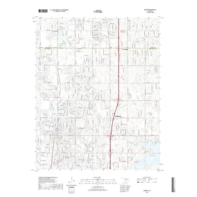
2018 Map of Edmond
USGS Topo · Published 2018About this map
Edmond and the surrounding borderlands of Logan and Oklahoma counties are captured here during a period of significant suburban expansion. The map detail reflects the transition from rural agricultural land to a grid of residential developments, particularly around the northern edges of the city. Older landmarks provide historical anchors amidst the newer subdivisions, including Waterloo Cem near the small settlement of Waterloo and Pleasant Hill Cem to the northeast.
Find a feature on this map
98 named features on this map. Tap any name to fly to it.
Don’t see what you’re looking for? This feature index may not catch every label — zoom into the map to look around manually.
Map Details
Editions of this 2018 Edmond Map
This is the sole edition of this map. No revisions or reprints were ever made.
Other maps of this area

1892 · Guthrie
USGS Topo · 1:62,500

1892 · Edmond
USGS Topo · 1:62,500

1892 · Kingfisher
USGS Topo · 1:125,000

1895 · Kingfisher
USGS Topo · 1:125,000

1935 · Spencer
USGS Topo · 1:24,000

1935 · Edmond
USGS Topo · 1:48,000

1940 · Edmond
USGS Topo · 1:62,500

1951 · Britton
USGS Topo · 1:24,000

1954 · Oklahoma City
USGS Topo · 1:250,000
1955 · Jones
USGS Topo · 1:24,000