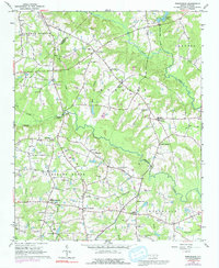
1964 Map of Edmondson
USGS Topo · Published 1992About this map
The rolling agricultural landscape of Cleveland and Pleasant Grove townships unfolds across this mid-century survey, defined by a dense network of family-named landmarks and rural hubs. Central to the local community is the aptly named Drug Store settlement, while McGee Mill and Johnson Crossroads anchor the southern reaches. The map is a significant resource for genealogists, detailing dozens of rural cemeteries like the Nimrod Stephenson Memorial Cem, Penny Cem, and Walton Cem, alongside numerous country churches including St Amandas Ch and Shiloh Ch.
Find a feature on this map
60 named features on this map. Tap any name to fly to it.
Don’t see what you’re looking for? This feature index may not catch every label — zoom into the map to look around manually.
Map Details
Editions of this 1964 Edmondson Map
Other maps of this area

1906 · Four Oaks
USGS Topo · 1:48,000

1908 · Four Oaks
USGS Topo · 1:62,500

1953 · Raleigh
USGS Topo · 1:250,000

1954 · Raleigh
USGS Topo · 1:250,000

1964 · Lake Wheeler
USGS Topo · 1:24,000

1964 · Garner
USGS Topo · 1:24,000

1964 · Selma
USGS Topo · 1:62,500

1964 · Angier
USGS Topo · 1:24,000

1964 · Clayton
USGS Topo · 1:24,000

1964 · Edmondson
USGS Topo · 1:24,000