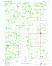
1961 Map of Edon
USGS Topo · Published 1974About this map
The village of Edon serves as a hub of activity in this rural landscape where the First Principal Meridian separates the farmlands of Ohio and Indiana. The map captures a detailed transition point between states, where the Norfolk and Western railroad corridor cuts through the agricultural grid. Local infrastructure is defined by its many crossings over Fish Creek, including the Shaffer Bridge, Anspaugh Bridge, and Enfield Bridge. Small social and religious centers like Alvarado and the Zion Ch are scattered across the townships of Richland and Florence. Of particular interest to researchers is the presence of numerous family and community burial grounds such as Eddy Cem, Bethel Cem, and Liggett Cem. The landscape is also marked by legacy education sites like Tamarack Sch and natural features like Burdick Lake, providing a clear look at the mid-century rural development of Williams and Steuben counties.
Find a feature on this map
35 named features on this map. Tap any name to fly to it.
Don’t see what you’re looking for? This feature index may not catch every label — zoom into the map to look around manually.
Map Details
Editions of this 1961 Edon Map
4 editions found
Other maps of this area

1914 · Pioneer
USGS Topo · 1:62,500

1914 · Bryan
USGS Topo · 1:62,500

1939 · Hamilton
USGS Topo · 1:24,000

1939 · Angola East
USGS Topo · 1:24,000

1939 · Clear Lake
USGS Topo · 1:24,000

1940 · Metz
USGS Topo · 1:24,000

1940 · Clear Lake
USGS Topo · 1:24,000

1943 · Bryan
USGS Topo · 1:62,500

1944 · Pioneer
USGS Topo · 1:62,500

1947 · Angola East
USGS Topo · 1:24,000